

NOEL & SONS
NOEL & SONS
Premium Geo-Spatial Solutions
Our Services
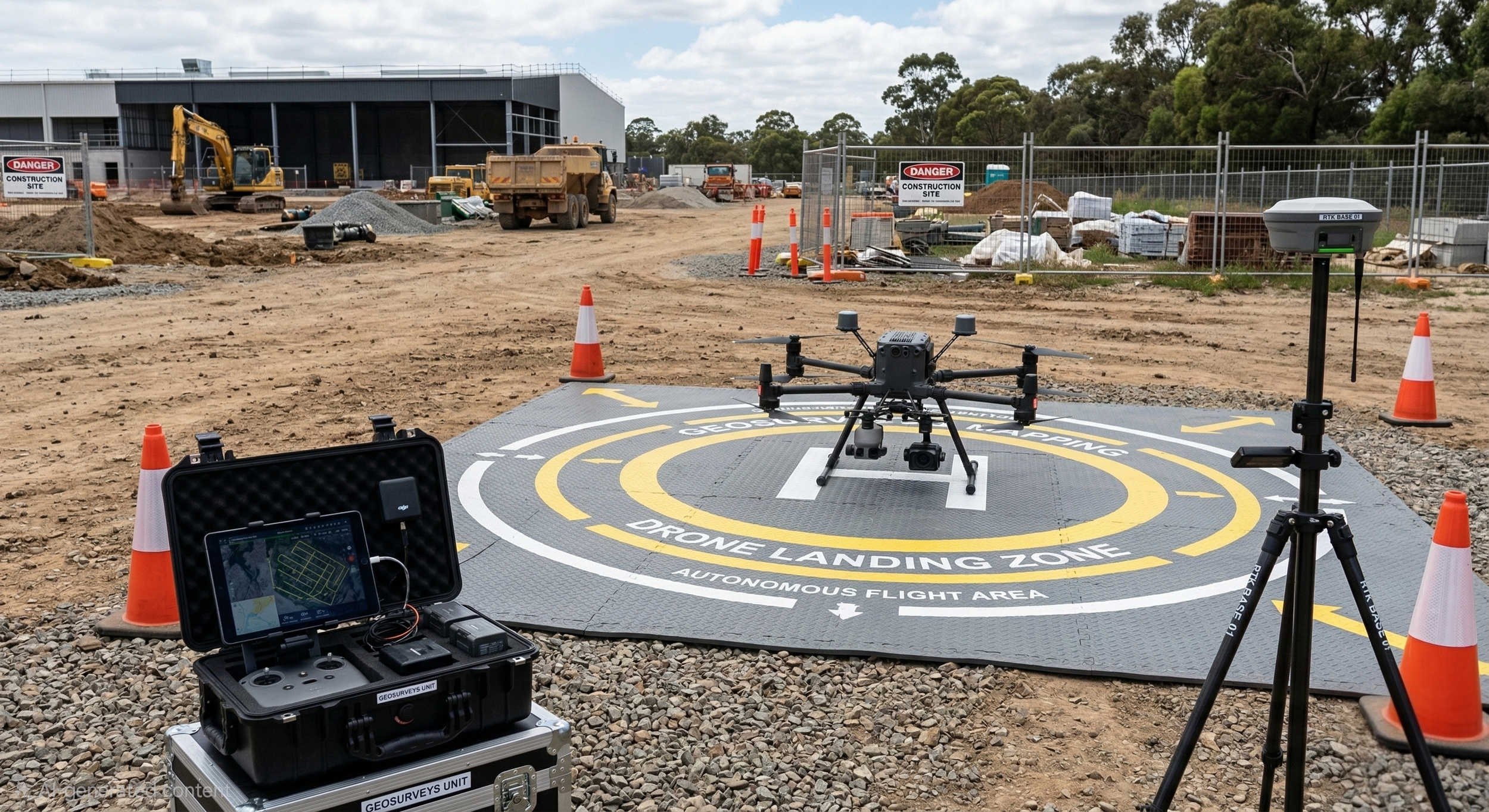
GEO SURVEYS & MAPPING
High-resolution aerial mapping and geospatial solutions designed to save time and reduce site risk. From topographic surveys to volumetric analysis, we provide a comprehensive digital overview. Accurate data delivered with the speed and flexibility of modern drone technology.
Based in North West London, Noel & Sons provides a client-focused approach to commercial consultancy and geospatial mapping. We pride ourselves on reacting promptly and efficiently to our clients’ requirements, ensuring every instruction is treated with professional rigor and technical expertise.
Our multi-disciplinary team consists of vetted Quantity Surveyors, certified Drone Pilots, and specialist Digital Surveyors. By combining traditional commercial management with advanced aerial data, we act as a bridge between high-level design and on-site financial reality. We hold full commercial insurance and industry-standard certifications, giving our clients absolute peace of mind.
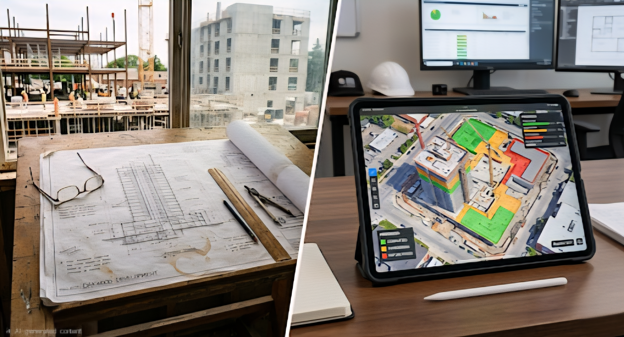
Working closely with leading Architects and Developers, we move projects from conception to completion. Our priority is to deliver projects on time and within the agreed budget, while utilising digital innovation to achieve the design requirements and commercial aspirations of our clients.

COMMERCIAL Consultancy
Expert financial oversight through precise cost reporting, internal valuations, and proactive commercial management. Our Quantity Surveyors handle cost, time and quality matters with precision to protect your project margins from inception to final account.
PROJECTS
SECTOR EXPERTISE Noel & Sons provides specialized consultancy across Residential, Commercial, and Infrastructure projects. By combining traditional Quantity Surveying with precision Geo-surveys, we tackle complex construction challenges with a data-driven approach. We have supported projects of all scales, providing the commercial clarity and technical accuracy needed to ensure project success from the ground up.
TEAM
PROFESSIONAL RIGOUR Based in North West London, our practice is led by a multi-disciplinary team of vetted Quantity Surveyors, certified Drone Pilots, and Digital Surveyors. We operate at the intersection of construction finance and geospatial technology, ensuring every instruction is backed by commercial insurance, industry certifications, and a commitment to professional excellence.
PARTNERS
INDUSTRY COLLABORATION We have built strong, strategic partnerships with leading Architects, Developers, and Interior Designers across London. Our collaborative network allows us to seamlessly integrate our digital mapping and commercial reporting into the wider design and construction process, delivering exceptional, high-precision results for our Residential and Commercial clients.
Combining advanced digital insights with expert commercial oversight for a modern construction landscape
Blog
Latest News


SEE THE FULL PICTURE
High-resolution drone surveys, 3D models, and thermal inspections—delivered fast by experts with 60+ years combined experience.
SCROLL
Built for builders, engineers, and property teams.
We combine cutting-edge drone technology with decades of construction expertise to deliver survey-grade data you can trust.
Typical turnaround: 48–72 hours
END-TO-END AERIAL SOLUTIONS
From site capture to Design -ready data. accurate, safe, and on schedule. Every time.

Surveying & Mapping
Topographic surveys
Volumetrics
Boundary mapping

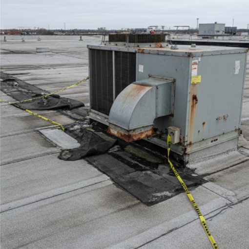
Inspections & Aerial Audits
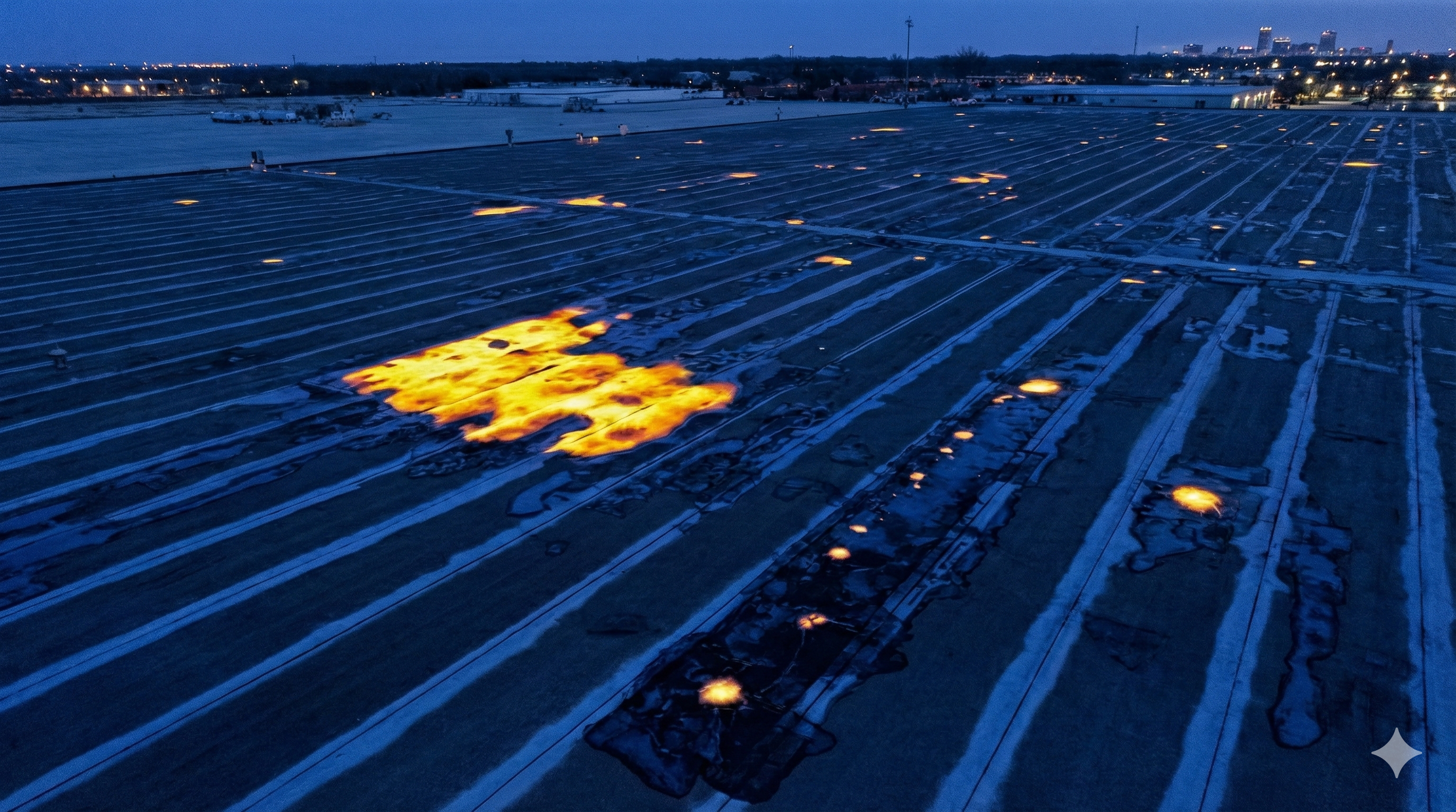
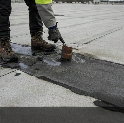
Roof & facade
Thermal imaging
Rail & infrastructure

Real-time Analytics
Progress tracking
Change detection
3D models
Next-Generation Construction Intelligence
By integrating high-fidelity aerial data, we help you;
Mitigate risk
Reduce overheads
Enhance Health & Safety
Maintain Stakeholder transparency and alignment.
Accelerated Data Collection.
Pro-Active Clash Detection & Error PreventioN.
Elevate your project standards with data that is as accurate as it is accessible.
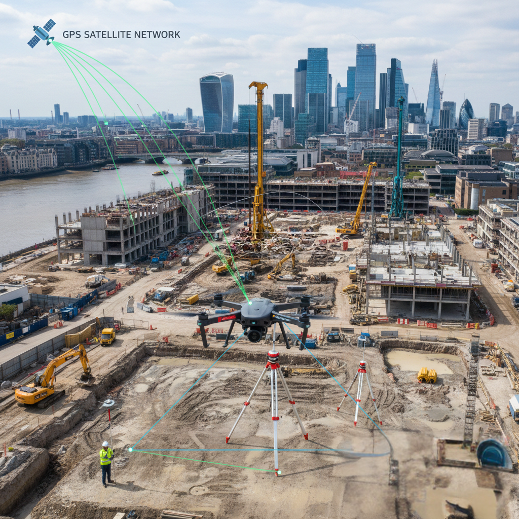
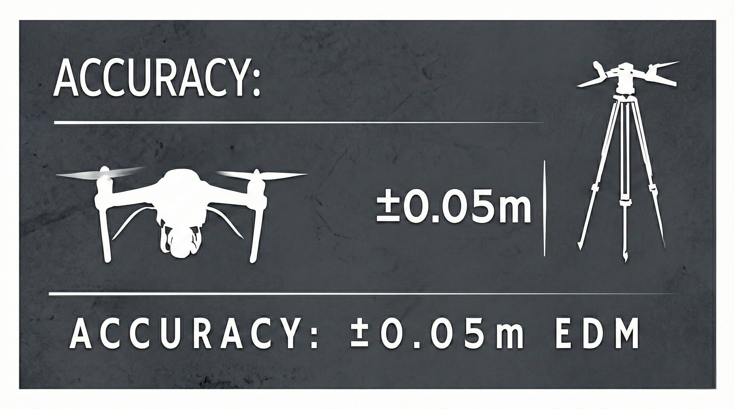
Data Integrity & Ground-Truth Accuracy
Measure with confidence RTK + Leica EDM Integration
By measuring the internal angles of triangles formed between the drone and EDM stations, we triangulate positions with horizontal and vertical accuracies of 1–3 cm and 2–5 cm, respectively.
Case Study: "Maintained 1cm horizontal precision for utility corridor mapping across 15 miles of varying terrain."
bridge the gap between vision and reality with centimeter-grade accuracy you can trust.

Industry-Leading Compliance & Drone Safety
Enhancing site safety through rigorous flight planning and vetted aerial expertise.
Safety is the foundation of our operations. We provide enhanced Health & Safety solutions tailored for high-stakes industries, including construction, inspections, and large-scale infrastructure. By integrating on-site surveys, detailed flight logs, and robust risk assessments, we eliminate the guesswork from aerial data collection.
Our team manages the entire operational lifecycle. This includes securing necessary permissions through flight restriction management and implementing on-the-ground pedestrian control to maintain a sterile field. With pilots vetted to GVC and A2 standards, we deliver a gold-standard service that meets the legal requirements of EC 785/2004, ensuring every flight is as secure as it is productive.
Aviation standards, applied to your industry.
Data sets & client deliverable exports
Actionable Insights Captured from Above, Delivered in the Formats You Use.
Bridge the gap between the physical site and your digital workspace. We provide high-fidelity, georeferenced data sets specifically formatted for seamless integration into CAD, BIM, and GIS environments. From bare-earth terrain models to dense 3D point clouds, our deliverables empower your team with actionable intelligence and sub-centimetre accuracy.
Our deliverable ecosystem is built for seamless integration. By providing data in industry-standard formats like .LAS, .DWG, & .RCP, we eliminate the friction between site capture and your design software. From high-accuracy topography to dense reality capture, every export is georeferenced and engineered for professional precision.
The ultimate digital record: comprehensive, compatible, and consistent.
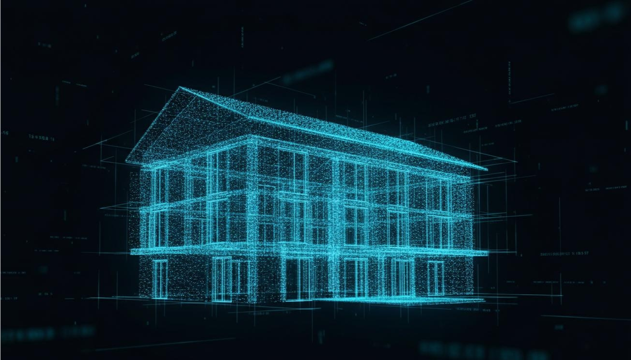
Point Clouds & Meshes
Deliverable: Dense 3D data for BIM, as-builts, and design coordination. Compatible with major software.
Exports: High-fidelity captures of assets & structures
Data Types: .LAS, .OBJ, .DXF
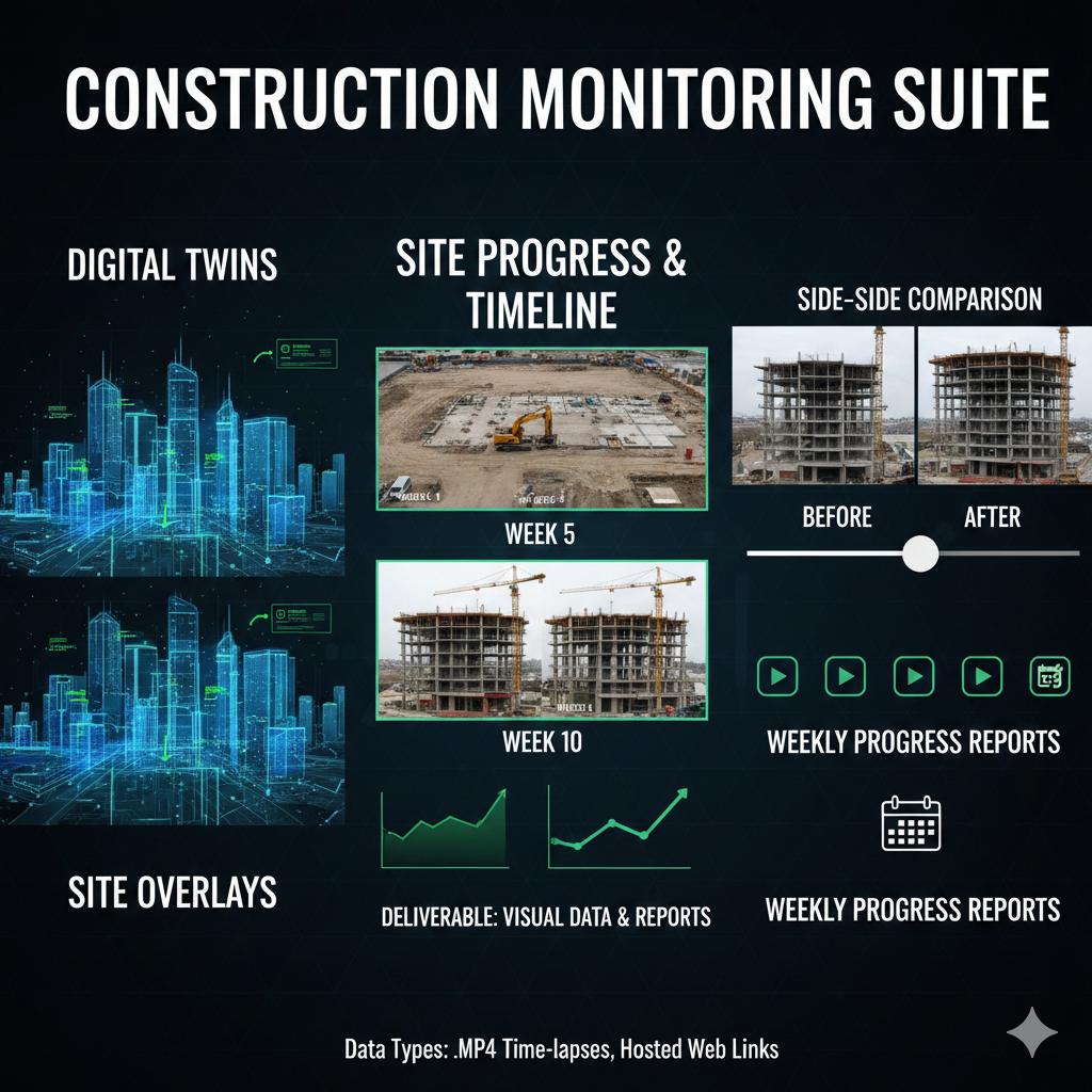
Site Progress & Timelines
Dense 3D data for BIM, as-builts, and design coordination. Compatible with major software.
Exports: Side-by-Side Comparison Sliders and Weekly Progress Reports.
Data Types: .MP4 Time-lapses, Hosted Web Links
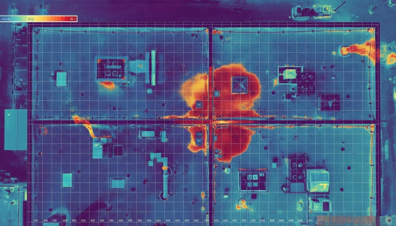
Thermal & Moisture Diagnostics
Specialised infrared mapping to detect heat loss, flat-roof leaks, or electrical hotspots.
Exports: Radiometric Thermal Maps and Annotated Moisture Inflexion Reports.
Data Types: .TIF, .JPG, .PDF
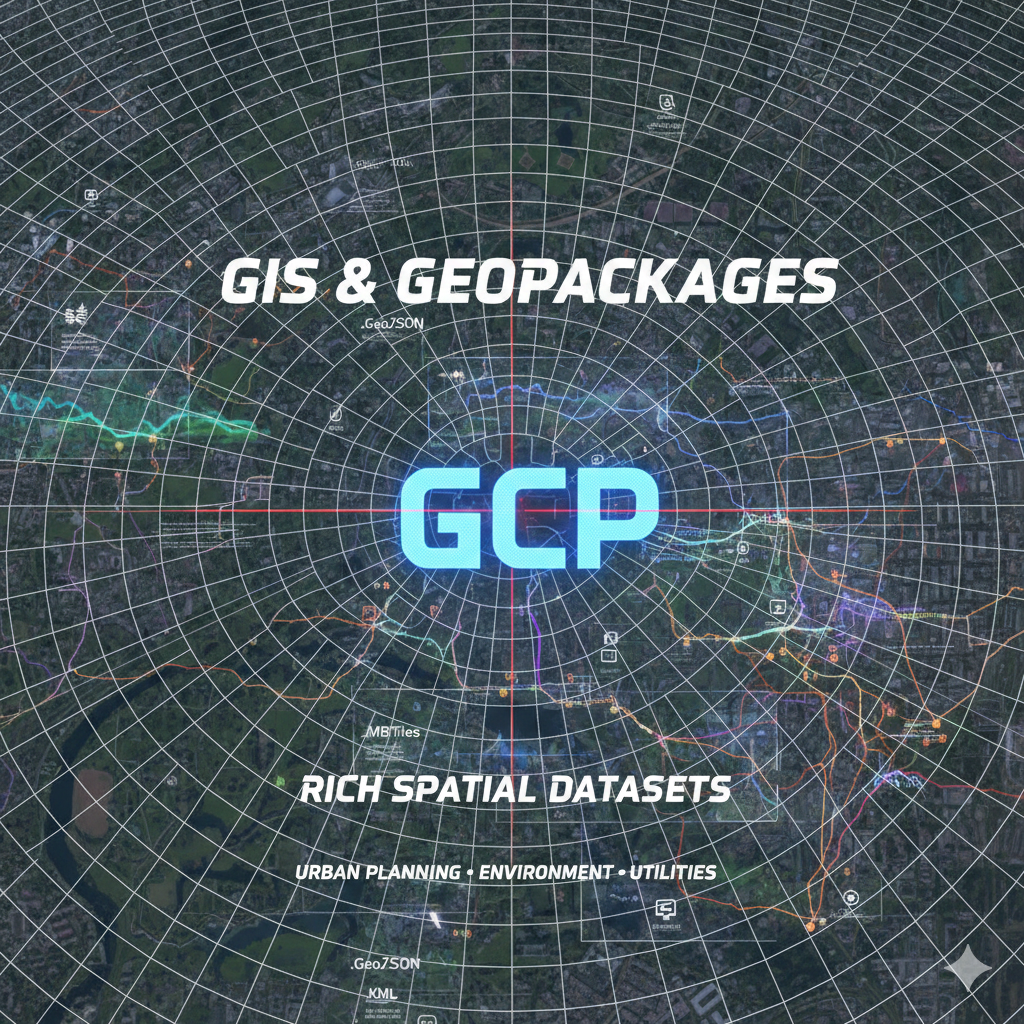
GIS & Geo-packages
Deliverable: Rich spatial datasets layered for urban planning, environmental studies, or utility mapping.
Exports: Georeferenced Orthomosaic Tiles and Shapefiles for regional analysis.
Data Types:
.GeoJSON,.KML,.MBTiles
-
.TIF
.DXF
.SHP
.PDF
.CSV
.XYZ
.DWG
.DXF
.IFC
.TIF
.JPG
.KML
.LAS
.OBJ
.MP4
PNG